
April 20, 2024
Follow us 


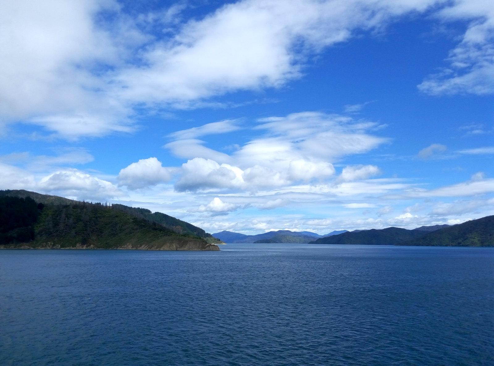
Sounds right Calm seas as the Kaitaki enters the Marlborough Sounds
VOLANTE Jack Yan and Amanda Satterthwaite pack their bags for a road trip of New Zealand’s South Island. In Part One, they depart from Wellington for Picton and head to Wanaka, going via Kaikoura. Tough roads lay ahead but they were more than rewarded by the landscape
Photographed by the authors
Jack Yan is publisher of Lucire. Amanda Satterthwaite is a writer and photographer for Lucire.
On November 14, 2016, a severe double-earthquake hit the South Island of New Zealand, with its epicentre near Culverden. The popular tourist town of Kaikoura was particularly hard-hit, with roads closed for weeks, and businesses suffering from cancelled holidays as well as an altered coastline, which initially limited whale-watching boat rides. The good news is that 83 per cent of Kaikoura’s activities and attractions are back up at the time of writing, and whale-watching, dolphin and albatross trips are again running daily.
While New Zealand is in the Pacific “ring of fire”, and has a nickname of ‘the Shaky Isles’, few earthquakes result in casualties. A Californian or an Oregonian would be used to the tremors that New Zealanders experience: one every few years might make the news. But this one, because it was felt in a larger city, namely Wellington, where demolitions of three buildings are taking place due to damage, merited greater global coverage.
That’s cold comfort to tourism operators who know that things are safe. There are many parts of the South Island where the ’quakes weren’t even felt, yet they, too, have suffered from cancellations. New Zealanders are conscientious when it comes to building safety and looking after visitors, and buildings are constructed to strict codes. We were privileged at Lucire to have taken in the sights mere weeks before the ’quakes, and we’re confident about recommending these as tourist destinations.
We travelled from Wellington to Picton via ferry, with our aim of going to Wanaka, a small town near the tourist hotspot of Queenstown (neither of which was affected by the earthquakes). While we could have flown straight to Queenstown Airport, and hired a rental car to make the journey to Wanaka, we wanted to see more of the country, especially parts that we had never been to before.
continued below
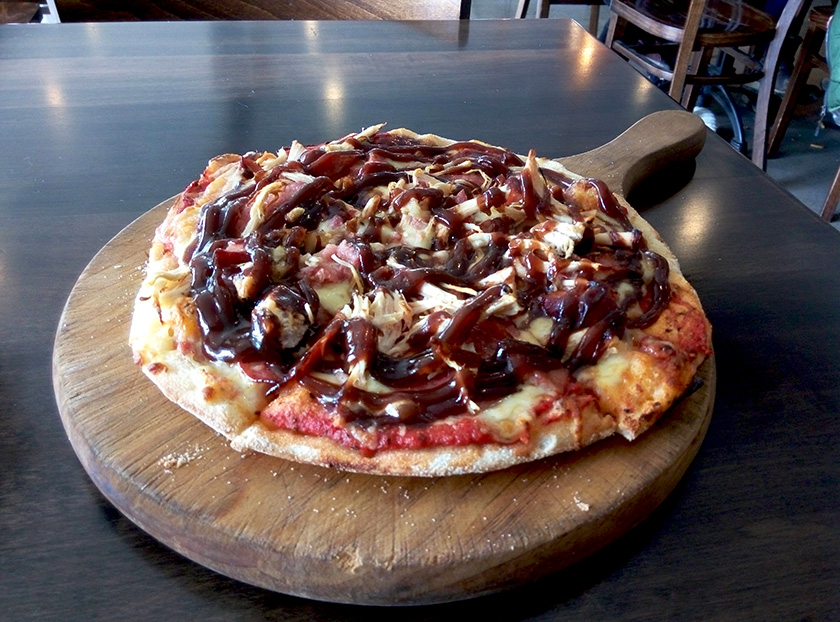
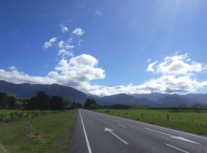
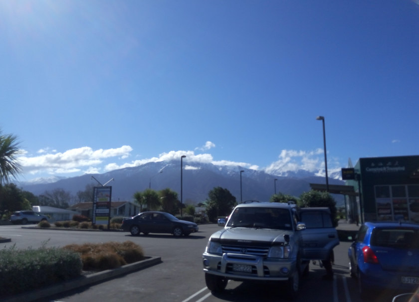 Above, from top: Meaty pizza at Café Cortado, Picton. The first sign of snow on the drive south at Clarence. Beautiful Kaikoura—affected by the earthquakes initially but with 83 per cent of its tourism activities back.
The last time I took the ferry from Wellington to Picton, it was 2000, and the Lynx, a fast catamaran which was later found to be damaging to marine life, operated between the two ports. These days, the choices, if you want to take your car with you, are limited to slower, conventional ferries: the Interislander line, run by the government, and Bluebridge, a family-owned business that had originally begun as a budget-priced competitor.
The Interislander won, but our journey out, on the first sailing of the morning (8 a.m. check-in, 9 a.m. departure) on the Kaitaki, wasn’t an easy one, with 3 m swells over Cook Strait. The captain sounded nervous as we set sail: while there’s no danger to 3 m, and crew reported having handled 6 m without difficulty, those who don’t have their sea legs could succumb to seasickness. Solution: we headed to the cinema on deck 2, where Bridget Jones’s Baby was playing, and paid extra for the tickets. (Bluebridge, meanwhile, says its movies are included in the fare, something we discovered ex post facto.)
Those with a bit of nautical experience tell us that that was the best thing we could do. Seasickness, they say, can go away if you’ve something else to focus on, and Rénée Zellweger, Colin Firth and Patrick Dempsey would prove just the ticket.
By the time the film finished, we were sailing in calm waters anyway. The swells were only in the Strait itself, and we were rewarded with outstanding views of the Marlborough Sounds as we gently sailed in.
First stop: Picton. Café Cortado’s pizzas were too good to resist. Being the first sailing, we made port at 12.30 p.m., a perfect time to have lunch. Cortado’s location gave a pleasant view of the harbour, and we could even fit in a nice walk after lunch and check out the shops on Picton’s main street. While Picton is an incredibly scenic town, and would have made for a delightful stop, we aimed to get to Christchurch that evening. Departing at 2.30 p.m., the sat-nav—running on Nokia’s Here Maps, namely an earlier version that actually worked—forecast a travel time of four hours. Knowing we would stop for breaks, we set our sights on a 7.30 p.m. arrival.
Driving in the South Island is relatively stress-free, because there’s no real rush hour in any of the smaller towns. There was some interesting red foliage in mid-spring and cherry blossoms abounded as we headed south going on the eastern side of the island. As we neared Clarence, we had our first sign of snow on mountain-tops in the distance, the last remnants of winter, set against a backdrop of blue skies. We stopped briefly there to take in the views, but more spectacular sights awaited.
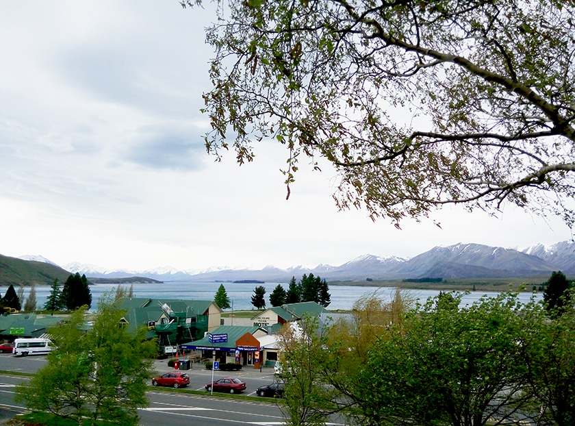
It wasn’t the first time we had been to Kaikoura, but we didn’t remember just how beautiful it was. Kaikoura is known best for its whale-watching encounters, but it’s also a haven for skiers. We went on the coast road at the time, but an alternative post-’quake inland route is now open, going through the particularly peaceful spots of St Arnaud, Murchison and the Lewis Pass. We journeyed on parts of this route later in the story, and locals were complimentary about the Lewis Pass road, enough to make us want to drive it on our next visit.
The snow-capped peaks just north of the Kaikoura township have always been sights to behold: on my first drive through the town from Christchurch a decade ago, it was the most welcome sight. The air is fresher here—you want to take in deeper breaths because you’re not sure if you’ve sampled anything this pure. Ski shops are well stocked, as is the local supermarket, and we made Kaikoura our pit stop for the first day’s drive.
Our first night was in Burnside, Christchurch, a particularly calm and beautiful area. While we didn’t head into the city proper, Ilam and Burnside showed that Christchurch deserves its title as New Zealand’s garden city. With temperatures often warmer than Wellington, despite being further south, Christchurch proved to be the best first stop as we rested our heads for the night, well fed and ready for a long drive ahead.
continued below
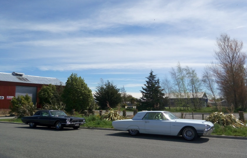
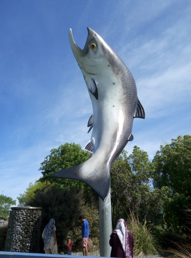
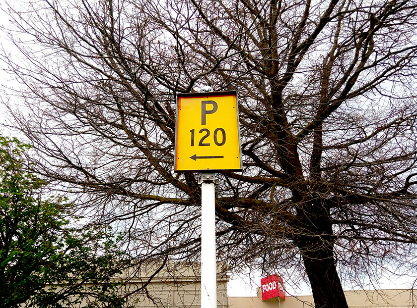 Above, from top: Ford Thunderbirds cruising at Rakaia. A tribute to local salmon fishing at Rakaia. An old parking sign at Fairlie.
On the map, Christchurch to Wanaka does not look like a long way, but this is deceptive to city-dwellers used to highways. We were advised by locally based family to head to Rakaia and divert to Thompsons Track, a less-travelled but more scenic route that would take in the start of some of the South Island’s mountain ranges. To a North Islander, that sounded like heaven: more snow-capped peaks of the variety we seldom see.
We grabbed a lunch at Rakaia, with locals who were keen just to get on with business, perhaps not aware that their park is a relaxing place to lie down and see dog-walkers; one woman talked to others about her rescue dog, and how she was considering the area for their next home. There were other people doing a road trip, too: parked behind the local café were two 1960s Ford Thunderbirds.
The claims about this inland route were right: Thompsons Track was the perfect road, skipping State Highway 1, and passing through Geraldine, a town whose homes look proudly cared for, as though everyone was competing in an unannounced Garden of the Year competition. From there, we rejoined Regional Highway 79, which we would have wound up on had we stayed on the main highway, and drove into Fairlie.
We were never bored. While the journey took hours, majestic snowy peaks kept us entertained as we marvelled at them, remarking to ourselves that we had reached ‘the real New Zealand’—the place that tourists often know and locals seldom discover.
Fairlie was a turning point, as we sensed the road ahead would be tougher and less well travelled. This was MacKenzie country, a sparsely populated part of the South Island, with Twizel its biggest town with fewer than 1,000 people. The Caltex station in Fairlie processed my fuel discount through two gadgets rather than the usual one: it looked like one calculated the discount while the other subtracted it. It went against the idea of technological convergence: why have one machine do it when you can have two?
Whilst there we learned about James MacKenzie (Seumas MacCoinneach in Gaelic) from a plaque by his statue: instead of being a rich farmer, as we had assumed him to be, he was a Scot, the first white man to get to the area, and a thief who had stolen 1,000 sheep from a Timaru station. He was convicted of the crime, and sentenced to five years’ hard labour. A regular escapist, he was ultimately pardoned, and left New Zealand for Australia in 1856.
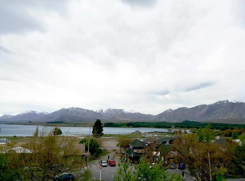
We reached Tekapo as the skies began to darken. Lake Tekapo is often photographed in tourist brochures, especially with the Church of the Good Shepherd in the foreground, and seen in Sir Peter Jackson’s screen adaptations of J. R. R. Tolkien’s The Lord of the Rings trilogy. Even with the clouds hovering, there was plenty of lakeside beauty, with the Mackenzie Basin’s mountains surrounding it. Beyond there was Aoraki, or Mt Cook, New Zealand’s highest point (3,724 m), and with the knowledge that there were more sights ahead, in an even more remote part of the country, we opted to push on.
Tekapo has rightly gained a reputation as a tourist destination, well served by backpackers and luxury resorts alike. One wouldn’t be remiss in staying the night there, but we were rewarded as we continued to Lake Pukaki, which presented, in our opinion, even better views than those afforded at Tekapo. Perhaps it was the brighter sky, but we had never seen water that particular shade of blue before, thanks to glacial flour, ground rock particles that make their way through a feed from the glaciers. In the distance was Aoraki, albeit covered by cloud at its peak. There were no resorts here spoiling the view north from the Lake Pukaki visitors’ centre and car park, and we gazed at a landscape that would have changed little over the centuries.
continued below
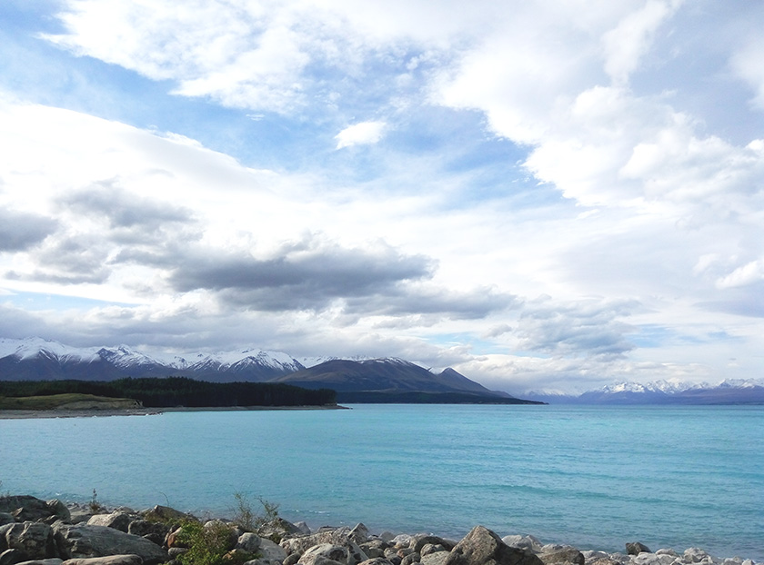
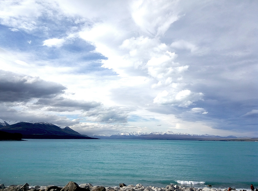 Contrasts Signs of tourism along the banks of Lake Tekapo, in the first two photographs; unspoilt beauty at Lake Pukaki, in the lower two.
However, where we stood was human-made: in developing a hydroelectric scheme, the southern outflow of the lake was dammed. New Zealand gets half its hydroelectricity storage between the two lakes. This could explain the absence of resorts here, but, as far as we were concerned, all the better. This was the most beautiful sight so far on the drive.
Twizel was only 7 km away, and we decided on a further shopping stop and dinner. It was getting dark now, and Wanaka was, according to the nav, still a couple of hours away. Again we had to revise our urban North Islanders’ perspective: 144 km might not sound like a lot, but in the dark, over an unlit Lindis Pass, it could actually be dangerous.
With those thoughts not quite in our heads yet, we sat down to dinner at Razza Bar, part of the local RSA (Returned Services’ Association, which looks after veterans’ interests). Razza served Thai food, too, and they catered for sophisticated palates. When we brought up our distaste of MSG with the innkeeper, he remarked, ‘That’s 621, isn’t it? No, we don’t use that here.’
By the time we reached Omarama, south of Twizel, it was dark, and set to get darker still. State Highway 8—the Lindis Pass—is a windy route that’s difficult to navigate without street lighting, and it’s not recommended for the inexperienced driver. We seldom saw the legal limit on here, preferring to go slowly and allowing more familiar drivers to overtake. Someone who might be more used to driving on the right would be well advised to traverse the Lindis Pass in the daytime, or get a ride in with a local. It wasn’t the most dangerous road we encountered, but it wasn’t one that we’d want to experience again in night-time conditions.
As always, persistence paid off as we drove into Wanaka. Again, night-time meant that we couldn’t appreciate its lake, but we were looking forward to resting our heads at a holiday home on Bills Way, and settling down for the week ahead.
Related articles hand-picked by our editors
 Splendid isolation
Blanket Bay in the Otago region
is rumoured to be a celebrity getaway. Jack
Yan sees a five-star boutique resort
photographed by Douglas
Rimington
From issue 16 of Lucire
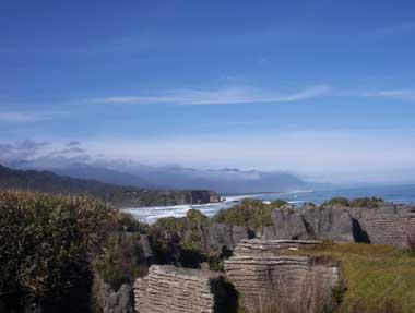 The wild west
New Zealand’s west coast, with its stunning Pancake Rocks, is a destination
for the adventurer by Jo Donnelly
photographed by the author and courtesy Hydrangea Cottages
 The good, the bad and the pretty
In Nelson, New Zealand, sampling the happening restaurants and playing
tourist in a town known for being a holidaying destination-but not everything
is up to international standards by Jack Yan
photographed by the author and Rachel McRae
Advertisement
Copyright ©1997–2022 by JY&A Media, part of Jack Yan & Associates. All rights reserved. JY&A terms and conditions and privacy policy apply to viewing this site. All prices in US dollars except where indicated. Contact us here.